
We are finding geospatial solutions for agri-urban land & water conflicts toward better use of them ...
1. Agricultural irrigation water use
Global irrigated croplands cover approximately 20% of the total but consume about 70% of worldwide freshwater withdrawals. Despite this importance, large uncertainties on the effects of irrigation on water use and the environment remain. In this research focus, we are using big geospatial data, data-driven models, and machine learning to know the following information for improved water management from field to global scales:
(1) where irrigated croplands are and how they change over time
(2) what are the techniques used for irrigation and their efficiencies
(3) how much water is extracted and where the water is from
Related publications:
Zhang, L., Xie, Y., Zhu, X., Ma, Q., & Brocca, L., 2024. CIrrMap250: Annual maps of China’s irrigated cropland from 2000 to 2020 developed through multisource data integration. Earth System Science Data Discussions, 2024, 1-31. https://doi.org/10.5194/essd-16-5207-2024.
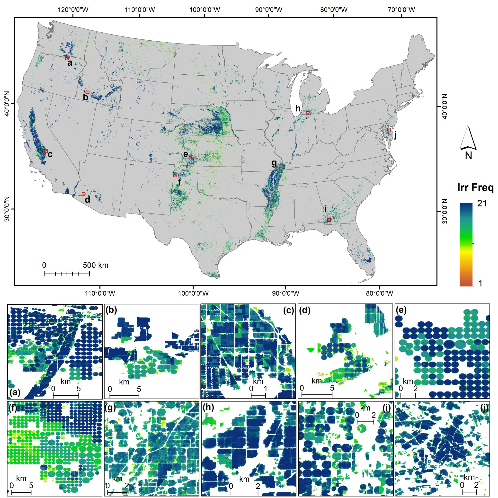
Xie Y., Gibbs H., and Lark T.J., 2021. "LANID-US: annual 30-m resolution irrigation maps for the conterminous United States, 1997-2017." Earth System Science Data, 13(12), 5689-5710. https://doi.org/10.5194/essd-13-5689-2021.
Xie Y. and Lark T.J., 2021. " Mapping annual irrigation from Landsat imagery and environmental variables across the conterminous United States." Remote Sensing of Environment, 260, 1-17. https://doi.org/10.1016/j.rse.2021.112445.
Ren J., Shao Y., Wan H., and Xie Y., 2021. "A two-step mapping of irrigated corn with multi-temporal MODIS and Landsat Analysis Ready Data." ISPRS Journal of Photogrammetry and Remote Sensing, 176, 69-82. https://doi.org/10.1016/j.isprsjprs.2021.04.007.
Xie Y., Lark T. J., Brown J. F., & Gibbs H. K., 2019. "Mapping irrigated cropland extent across the conterminous United States at 30 m resolution using a semi-automatic training approach on Google Earth Engine." ISPRS Journal of Photogrammetry and Remote Sensing, 155, 136-149. https://doi.org/10.1016/j.isprsjprs.2019.07.005.
Datasets:
1) LANID Annual irrigation extent maps (1997-2917)
download: https://zenodo.org/record/5548555
Please contact us (yanhua.xie@ou.edu) for LANID after 2017.
2. Agri-urban land use competitions
The earth has undergone unprecedented urbanization in recent decades and the global development of land consumes some of our planet’s most productive agricultural lands. This conversion is usually irreversible—once urbanized, agricultural lands are very unlikely to be recultivated. Such losses of agricultural lands already pose a substantial threat to local and regional food security. It is projected that the trends of urbanization-induced cropland loss will continue if no actions are taken. Given an increasing population and its attendant growing need for food and fuel, protecting existing agricultural lands is critical, especially under the compounding stresses of climate change, extreme weather, armed conflicts, and public health crises such as the COVID-19 pandemic.
In this research focus, we are integrating multi-source geospatial data, land use science, and machine learning to understand complex agri-urban land use competitions with the aim of saving limited lands for both food security and sustainable urban development. More specifically, our research covers:
(1) map, monitor, and project urbanization and cropland dynamics
(2) understand the urbanization process of agriculture lands
(3) predict and protect croplands under threat of urbanization
(4) translate our scientific findings into actionable changes
Related publications:
Xie, Y., Spawn-Lee, S. A., Radeloff, V. C., Yin, H., Robertson, G. P., & Lark, T. J., 2024. Cropland abandonment between 1986 and 2018 across the United States: spatiotemporal patterns and current land uses. Environmental Research Letters, 19(4), 044009. https://doi.org/10.1088/1748-9326/ad2d12.
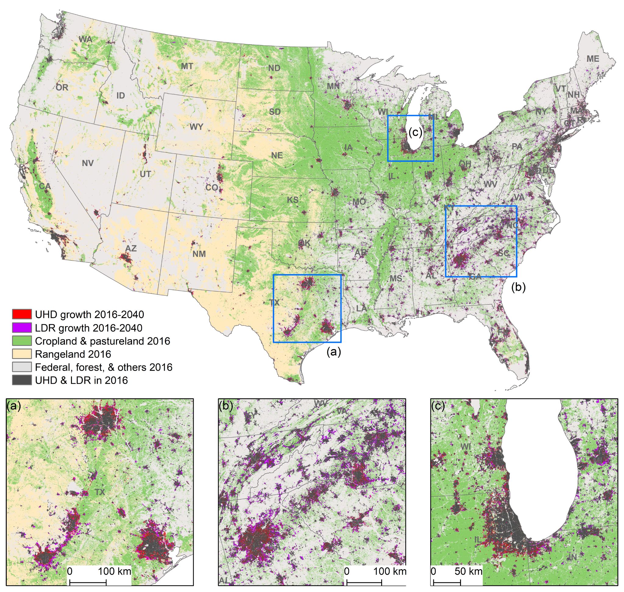
Xie, Y., Hunter, M., Sorensen, A., Nogeire-McRae, T., Murphy, R., Suraci, J.P., Lischka, S., Lark, T.J., 2023. U.S. Farmland under Threat of Urbanization: Future Development Scenarios to 2040. Land, 12, 574. https://doi.org/10.3390/land12030574.
Xie Y., Weng Q., and Fu P., 2019. "Temporal variations of artificial nighttime lights and their implications for urbanization in the conterminous United States, 2013–2017." Remote Sensing of Environment, 225: 160-174. https://doi.org/10.1016/j.rse.2019.03.008.
Xie Y. and Weng Q., 2017. "Spatiotemporally enhancing time-series DMSP/OLS nighttime lights for mapping large-scale urban dynamics." ISPRS Journal of Photogrammetry and Remote Sensing 128: 1-15. https://doi.org/10.1016/j.isprsjprs.2017.03.003.
Xie Y. and Weng Q., 2016. "Updating urban extents with nighttime light imagery by using an object-based thresholding method." Remote Sensing of Environment 187: 1-13. https://doi.org/10.1016/j.rse.2016.10.002.
Datasets:
(1) US croplands under threat of urbanization by 2040
Interactive map: https://development2040.farmland.org/
AFT reports using our maps: https://farmlandinfo.org/publications/farms-under-threat-2040/
(2) US cropland abandonment map, 1986-2018
Available at: https://atlas.glbrc.org/
Or contact us (yanhua.xie@ou.edu) for GEE link
3. Agri-urban water use conflicts
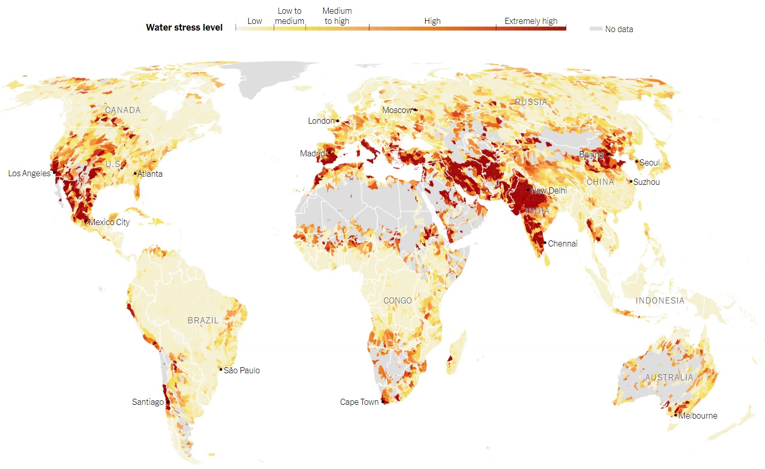
Water use competition between urban and agricultural sectors is a complex and pressing issue, particularly in regions where water resources are limited. Residential demands for water, driven by population growth and urbanization, often clash with the needs of agriculture, which relies heavily on irrigation to sustain crop production. This competition intensifies during periods of drought or water scarcity, which are further exacerbated by the unpredictability of climate change.
To better understand agri-urban water use competition and ensure more sustainable use of this vital resource, we are developing geospatial, data-driven, and machine learning models to:
(1) estimate residential and agricultural irrigation water use
(2) identify areas where agricultural and residential water use conflict
(3) enhance water resource management at agriculture-urban interfaces